Keith's Winter Forecast
It’s that time of year when the weather weenies and ski bums start getting stoked for winter. And with that excitement, they inevitably want to know - "Will this be a big snow winter?"
First, it’s important to know that seasonal forecasting has a much lower “skill score” compared to even medium range forecasting that spans out 15 days.
There are two main reasons for this:
1) The general rule of forecasting, of course, is that the farther out in the future you get, the less accurate it becomes. A 2-day forecast is statistically more accurate than a 3-day forecast, the 3-day is more accurate than a 4-day, etc, etc.
2) When you’re trying to predict snowfall amounts at a seasonal level, you can get the macro conditions correct (i.e., colder than average, wetter than average) and still get the snowfall forecast wrong. That’s because a shift of a Nor’easter track by say 50 miles can be the difference between a 20” snowstorm and a total miss (or rain). That 20” ends up being statistically significant and there’s no possible way to forecast a specific storm track months in advance (and once we DO have the models to do that, I’ll be out of a job).
Enough excuses though, let’s talk about what we DO know.
El Niño vs. La Niña
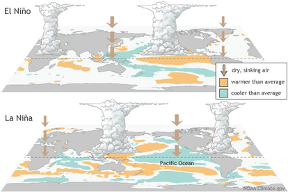
One of the best tools meteorologists (not hacks like Donny Pelletier) can look at for seasonal forecasting is the El Niño-Southern Oscillation, also known as ENSO.
There are two phases of ENSO: One is El Niño, which is when the ocean surface temperatures in the central and east-central Pacific are running warmer than average. The other is La Niña, which is when ocean surface temperatures are running cooler than average.
The phase of ENSO changes the wind and rainfall patterns in the tropics, which then impacts weather patterns across the globe.
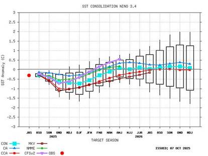
Right now, we are in a weak La Niña phase, and the long-range models that help predict ENSO phases all favor staying in a weak La Niña through December, January, and February. See graph:
So What?
In general, a weak La Niña is good news for snow lovers in the Northeast, as it can promote ridging in the West with an active storm track in the East with troughing.
Again, these are broad strokes, but all else being equal, you’d rather be in a La Niña if you’re hoping for an above-average snow season.
I think that’s especially true in the mountains of Northern New England, as they are a bit more protected from coastal storms changing over to rain.
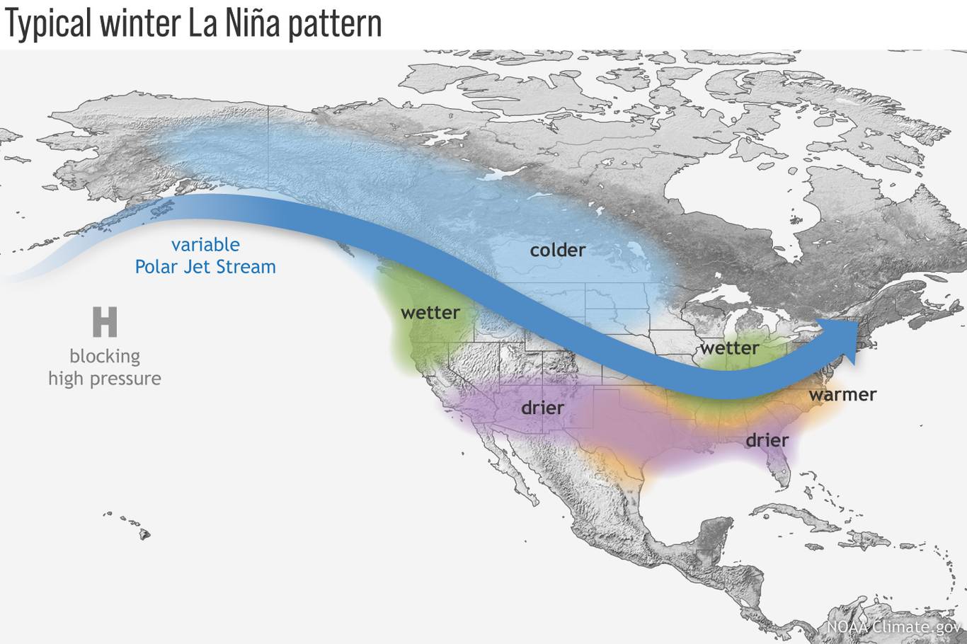
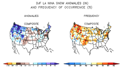
Running La Niña years back to 1950 bears this out (I know this graphic is pixelated, but this is how science stuff works, ok?), showing some of the strongest above-average snowfall anomalies associated with La Niñas actually occur in Maine and New Hampshire.
So these are all good signs if you are hoping for more pow days this winter, but keep in mind the season can always be made or broken on a few specific storm tracks.

Keith Carson is a meteorologist at NEWS CENTER Maine in Portland, specializing in forecasting and climate analysis.
Keith has a Bachelor of Science in meteorology from Lyndon State College. He was voted “Best of Maine” Downeast Magazine readers' choice 2017-2018 “Best Meteorologist” Readers' Choice Portland Phoenix 2018, and named Hottest Newsmen on Buzzfeed 2017. (Seriously).
Follow Keith on Instagram @KeithCarsonWeather